Gallery
The Badminton Association of India (BAI) has announced a 14-member-strong India squad for
- Men’s Sr Hockey Nationals to be played in division-based format from April 4
- Mensik denies Djokovic 100th title in Miami final
- KIPG: Son of a vegetable vendor, Bihar’s Jhandu Kumar eyes Worlds, 2028 Paralympics
- Hardik Singh credits hard work and team unity for receiving HI Midfielder of the Year award
- Djokovic, Alcaraz land in same half of Miami draw
| Heatwave hits North India, IMD issues 'red alert' | ||||||||
|
||||||||
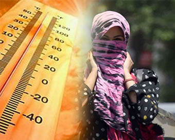
The India Meteorological Department (IMD) said that heatwave conditions are slated to peak on Tuesday due to prevailing dry winds blowing over northwest India, central India and adjoining interior parts of eastern India. IMD's Deputy Director General of Meteorology K.S. Hosalikar said: "Please watch out for hot afternoons and avoid going out between 11 am and 3 pm."
Heat conditions will persist over Haryana, Chandigarh, Delhi, Rajasthan, Uttar Pradesh, east Madhya Pradesh, and Vidarbha till May 28.
Hot weather conditions will also prevail in isolated pockets over Punjab, Chhattisgarh, interior Odisha, Gujarat, Maharashtra, interior Andhra Pradesh, Telangana, Bihar, and Jharkhand for the next two to three days.
Churu city in Rajasthan recorded a maximum of 47.5 degree Celsius on Monday, the highest of the season so far.
Dr Kuldeep Srivastava, head of IMD's Regional Weather Forecasting Centre, said that there will be some respite from May 28 night when the Western Disturbance will affect northwest India and easterly winds will also prevail at lower levels of the atmosphere.
"Dust storm and thunderstorm with strong gusty winds of 50-60 km per hour are likely to occur on May 29 and 30 over NCR-Delhi," he added.
The Western Disturbance is a cyclonic storm that originates in the Mediterranean Sea and travels across central Asia. When it comes in contact with the Himalayas, it brings rains to the hills and the plains.
Due to strong southerly wind from the Bay of Bengal, heavy to extremely heavy rain is expected at isolated places over Assam, Meghalaya, and Arunachal Pradesh till May 28.
According to Mahesh Palawat of Skymet Weather, a private weather forecasting agency, Pasighat in Arunanchal Pradesh has recorded 146 mm of rainfall.
"Golpara and North Lakhimpur also recorded heavy rain, leading to flooding in many parts of Assam and Meghalaya," he added.
Intense weather activity was also witnessed over interior parts of Karnataka, including in state capital Bengaluru, leading to uprooting of trees and waterlogging.
The IMD said that Pasighat, Cherrapunji, Gangtok, Itanagar, Lakhimpur, Jorhat, Tezpur, Tangla, Haflong, Malda, Kodaikanal and Periakulum recorded rainfall of one cm or more on Monday.
Conditions are becoming favorable for further advance of Southwest Monsoon into some more parts of south Bay of Bengal, Andaman Sea, and adjoining central Bay of Bengal around May 27, it added.
| ||||||||
| ||||||||
| For Latest Updates Please- Join us on  Follow us on  |
||||||||

